
Prescribed Burns Planned Across Shasta-Trinity National Forest This Week
Forest officials schedule multiple fuel-reduction projects from McCloud to Trinity Lake as conditions allow.

The Shasta-Trinity National Forest has announced a series of prescribed burns scheduled to begin Monday, November 17, with operations expected to continue through Friday, November 21, as weather and safety conditions permit. Officials say the burns are part of ongoing efforts to reduce hazardous vegetation and lower the risk of large, destructive wildfires across the region.
According to the U.S. Forest Service, prescribed fire is used to thin overgrown fuels, protect nearby communities, and maintain forest health. All planned burns are dependent on real-time weather and air quality evaluations, and may be postponed if conditions shift.
The planned prescribed fire projects include:
McCloud Ranger District
• Lower McCloud (Beartrap) Pile Burn near the Cabin Creek Trailhead — 100 acres
• McFalls Landing Piles north of McCloud River Loop — 8 acresMount Shasta Ranger District
• Azalea Landing Pile Burn east of Mount Shasta City — 15 acres
• Everitt Machine Pile Burn near McBride Springs Campground — 20 acres
• McBride Landing Piles along Everitt Memorial Highway — 11 acresShasta Lake Ranger District
• I-5 (Skyline) Pile Burn across multiple sites between Packers Bay and Antlers Bridge — 290 acres
(This project includes piles created in partnership with the Western Shasta Resource Conservation District and a Forest Health Grant funded by the State of California.)Weaverville Ranger District
• Ridgeville Pile Burn near the communities of Ridgeville and Estrellita, close to Trinity Lake — 100 acresYolla Bolla Ranger District
• Red Mountain Pile Burn south of State Route 36 — 213 acres
Forest officials warn that some of these areas may be closed to the public during operations. Visitors should watch for posted signs and use caution when traveling near active burn areas.
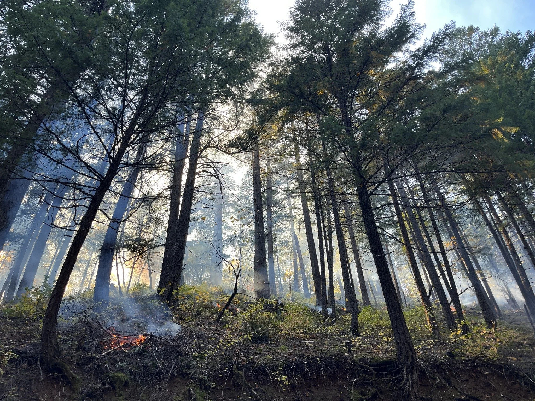
(Shasta-Trinity National Forest)
Residents in surrounding communities may notice smoke at times throughout the week. The Forest Service recommends checking air quality conditions through the AirNow website or app. Drivers encountering smoke on roadways are reminded to slow down, turn on headlights, and use caution.
Fire managers will continue monitoring weather conditions in the hours leading up to each ignition. Any burns that do not meet required safety criteria may be delayed.
Updates will be posted on the Shasta-Trinity National Forest website, official social media channels, and InciWeb. County emergency management offices will be notified when ignitions begin.
Cover image: Shasta-Trinity National Forest