
King Tides and High Surf Collide This Week
High Surf Advisory Issued for Oregon Coast as King Tides Approach
MEDFORD, Ore. — The National Weather Service (NWS) in Medford has issued a High Surf Advisory for the South Central Oregon Coast, warning residents and visitors of dangerous ocean conditions expected this week as King Tides coincide with large breaking waves.
The advisory will be in effect from 7 p.m. Tuesday, November 4, through 10 p.m. Thursday, November 6, and includes areas from Coos Bay south through Curry County. Officials say waves could reach 20 to 25 feet, creating hazardous surf and the potential for minor coastal flooding.
A Coastal Flood Watch has also been issued from late Wednesday night through Thursday evening, as rising tides are expected to combine with the high surf.
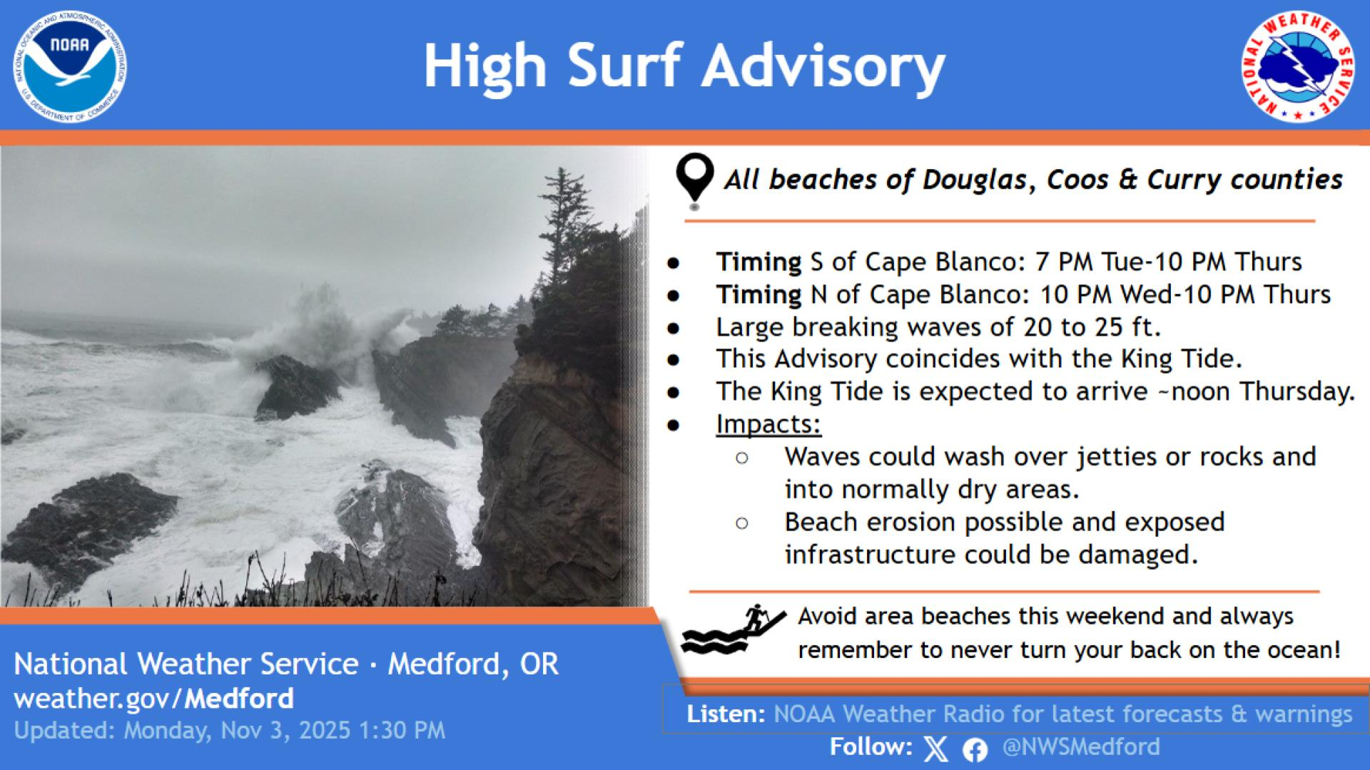
Conditions and Impacts
According to NWS Medford, the powerful combination of incoming King Tides and long-period swells could lead to:
Large breaking waves reaching up to 25 feet
Beach erosion and flooding in low-lying coastal areas
Damage to exposed infrastructure such as roads, parking lots, and sea walls
Dangerous conditions near jetties, tidepools, and cliffs
The agency cautioned that even experienced beachgoers and storm watchers should use extreme caution, as “sneaker waves” can quickly surge far beyond the normal surf line.
“Large breaking waves will create hazardous conditions along and within the surf zone and could inundate beaches and low-lying shorelines,” the weather service said in its advisory. “If travel is required, allow extra time as some roads may be closed. Do not drive around barricades or through water of unknown depth.”
Areas Affected
The advisory covers the South Central Oregon Coast, including communities near:
Coos Bay
Bandon
Port Orford
Gold Beach
Brookings
West-facing beaches will be most exposed to the incoming swells and are expected to experience the most severe surf conditions.
Safety Tips
The Oregon Parks and Recreation Department (OPRD) and NWS Medford recommend the following safety measures during this high surf period:
Stay off jetties, rocks, and logs, as waves can easily knock people into the water.
Watch from a safe, elevated location — such as a designated viewpoint or cliffside turnout.
Keep a safe distance behind warning signs, cones, and safety barriers.
Never turn your back on the ocean, especially during King Tide events.
Avoid driving through flooded coastal roads or areas with standing water.
Officials also urge anyone visiting the coast this week to be mindful of shifting sand, unstable cliffs, and changing weather conditions, which can make beaches treacherous even after the tides recede.
The Role of King Tides

This week’s advisory coincides with the first King Tide event of the 2025–2026 season, expected from November 5–7. King Tides are the highest tides of the year, caused by the gravitational alignment of the Earth, moon, and sun. When these extreme tides align with storm systems, the result can be dramatic surges and flooding along coastal areas.
NWS officials note that these events, while visually stunning, highlight the ongoing impact of rising sea levels and coastal erosion across the Pacific Northwest.
Stay Informed
Residents and visitors are encouraged to monitor weather updates from official channels:
weather.gov/Medford
NOAA Weather Radio
@NWSMedford on social media
For those heading to the coast, it’s best to plan ahead and check for local beach closures or access restrictions before traveling.
HiveWire Daily will continue to monitor this story and provide updates as conditions develop. Stay tuned for more on the King Tide season and how to safely experience Oregon’s powerful coastal forces.